


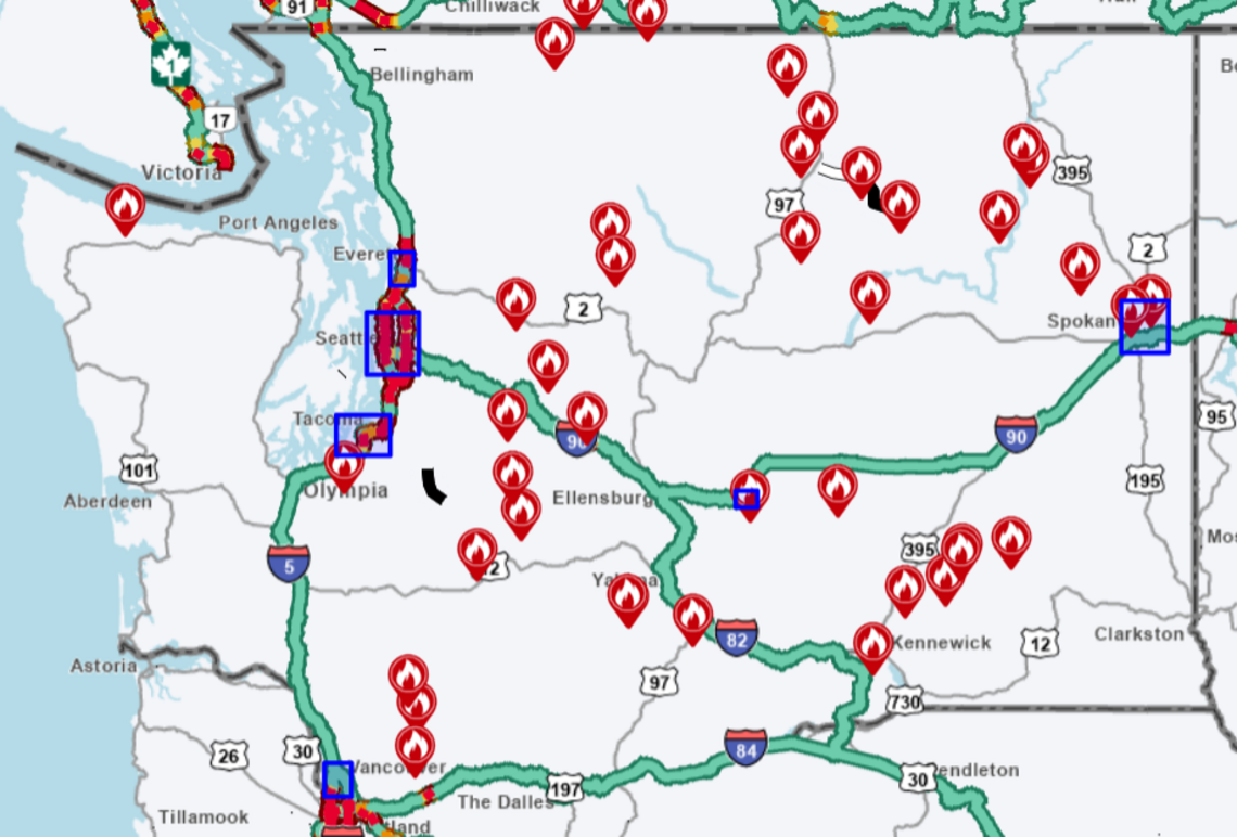
Wildfire activity continues across Washington state as residents use online tools to monitor fires, smoke conditions, and potential threats to nearby communities.
According to state officials, more than 1,000 wildfires have been reported across Washington in 2026, burning over 378,000 acres. Combined with large fires in neighboring Oregon, more than 1.5 million acres have been affected across the Pacific Northwest this year.
As smoke spreads across parts of the region, many residents are looking for reliable ways to determine how close active fires are to their homes and communities.
Several online resources are available to help track wildfire activity throughout the state.
One of the most widely used tools is the Washington State Department of Transportation Real-Time Travel Map. The interactive map includes a wildfire layer that allows users to view recent and active fires across Washington.
By selecting wildfire information on the map, users can see the location of a fire and access details such as when it started, the estimated acreage burned, and current conditions.
Another important resource is the wildfire mapping system maintained by the Northwest Interagency Coordination Center.
The map provides detailed information about wildfire locations, containment levels, causes, and total acreage affected. It also identifies whether nearby homes, businesses, or other structures may be at risk from an active fire.
In addition to the map, the coordination center publishes regular updates and summaries about significant fires throughout the region.
Residents can also use the Western Fire Chiefs Association Fire Map, which offers near real-time wildfire information from multiple sources.
The system combines data from the U.S. Forest Service, the National Interagency Fire Center, and emergency dispatch information to provide updated fire activity across the western United States.
Officials say these tools help residents stay informed and make timely decisions during wildfire season.
Several major wildfires remain active in Washington.
Among the largest are the Kaiser Canyon Fire and the Sinlahekin Fire in Okanogan County. Together, the two fires have burned nearly 130,000 acres, making them among the most significant incidents in the state this year.
In Yakima County, the Signal Peak Fire and the Ransier Fire have damaged multiple homes near White Swan. Combined, the fires have burned close to 4,000 acres.
Fire crews continue working to contain the blazes and protect nearby communities.
Near Leavenworth, the Little Giant Fire has grown beyond 24,000 acres and remains only partially contained.
Further north, the Ptarmigan Fire has expanded to more than 14,000 acres.
Emergency responders continue monitoring conditions as dry weather and wind create challenges for containment efforts.
Wildfire activity is not limited to Washington.
Oregon has also experienced a severe fire season, with wildfires threatening forests, wilderness areas, and residential communities.
Thousands of residents have been forced to evacuate in some areas as fires continue to spread.
Smoke from both Washington and Oregon fires has affected air quality across large portions of the Pacific Northwest.
Health officials encourage residents to monitor local air quality reports and limit outdoor activity when smoke levels become unhealthy.
For Washington residents seeking the latest wildfire information, the Washington State Department of Natural Resources remains the primary source for updates.
The agency maintains an online wildfire dashboard that provides information on active fires, regional burn bans, and emergency conditions.
Officials regularly update the dashboard as new information becomes available.
The department also shares wildfire updates through its social media channels, including its dedicated wildfire information account.
During major incidents, agencies often provide additional updates through local emergency management offices and community alert systems.
The Washington Wildfire Maps available through state and regional agencies offer residents important tools for tracking fire activity, monitoring risks, and staying informed throughout the wildfire season.
As conditions continue to change, officials encourage residents to follow trusted sources and remain prepared for potential wildfire impacts in their area.
