


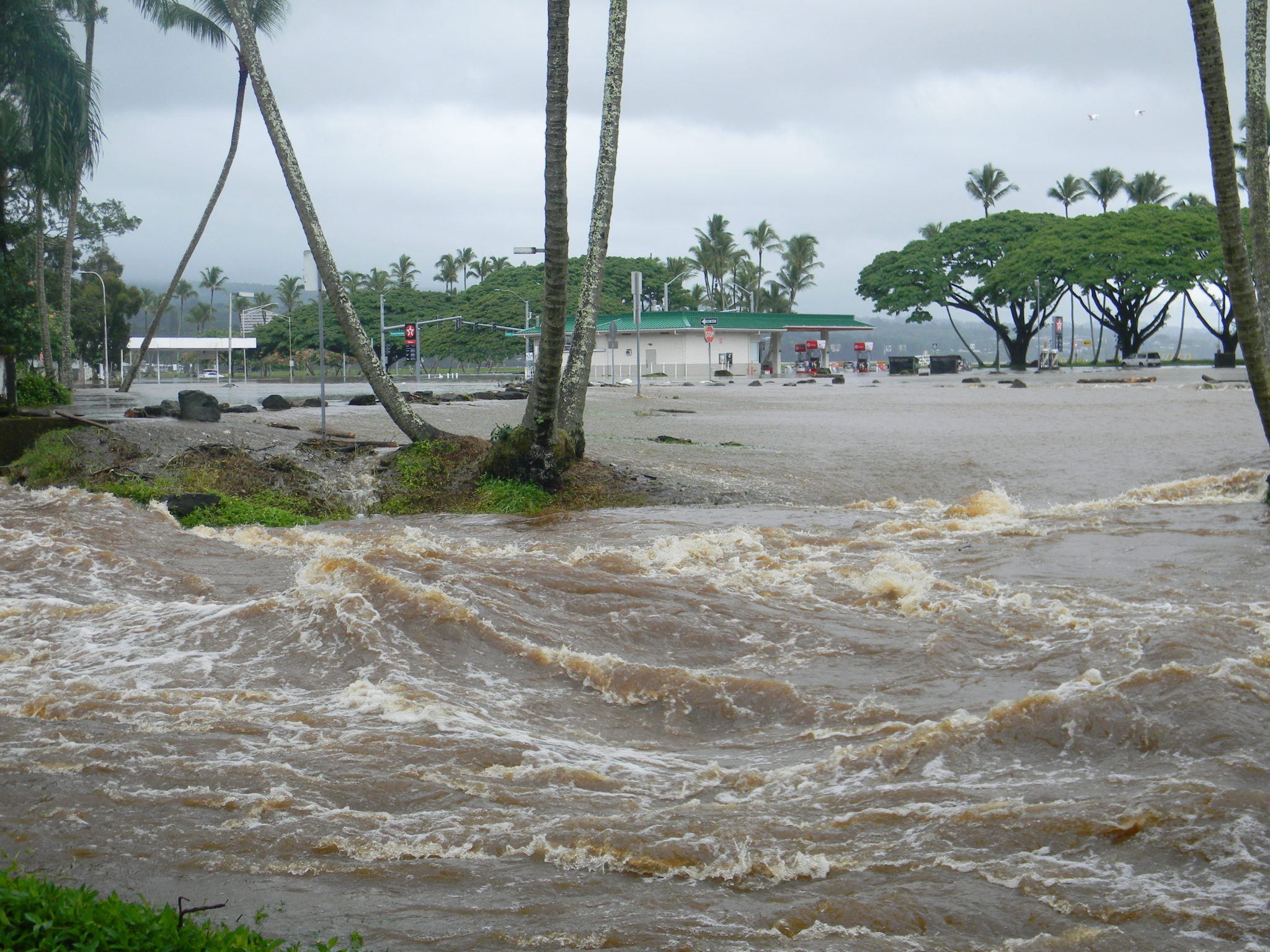
A powerful weather system named Hurricane Lala is causing major trouble across the region. The storm intensified into a Category 1 hurricane on Saturday morning. Severe downpours and strong wind gusts are striking southern communities right now. Official warnings urge all local residents to stay indoors and protect their homes.
A formal hurricane warning covers the entire island. Sustained winds have topped 74 miles per hour as the core moves near land. Outer storm bands are bringing rapid rain to both coastal areas and mountain towns. The main body of the storm is making its closest approach during the afternoon hours.
A direct strike by a hurricane is a rare occurrence for this area. The state has not seen a storm core make direct landfall in more than thirty years. Emergency teams are tracking weather radar to watch where the eye travels. Even without a full landfall, severe hazards affect every county across the region.
Torrential rainfall presents the most serious danger from Hurricane Lala Big Island Hawaii. Heavy water flow is filling local gulches and swelling rivers fast. Weather sensors recorded over twelve inches of rain in Keanakolu in twenty-four hours. This quick influx of water creates an instant hazard for local neighborhoods.
Forecasters warn that total rain could easily pass twelve inches in many areas. Isolated spots on steep slopes may see over two feet of water. A single foot of rain in Hilo equals more than an entire average month of precipitation. This extreme rain brings a swift risk of deep flash floods. Mountain hillsides also face a severe threat of sudden mudslides that ruin roads.
High winds are creating additional dangers for local towns. Strong gusts can break heavy tree branches and pull down power lines. Utility crews stand ready to repair damaged gear once wind speeds drop. Power cuts may affect many homes for extended periods over the weekend.
Public safety authorities urge everyone to take simple actions to stay safe. People should refrain from driving on flooded streets where water moves fast. Quick streams can easily wash away large motor vehicles. Emergency management centers have set up public shelters to house families from low zones.
Local topography makes emergency response work more complex. High mountain peaks disrupt passing clouds and trigger localized heavy rain showers. Coastal areas are also seeing large sea waves driven by strong storm winds. High ocean tides paired with big swells increase beach damage along vulnerable coastlines.
Disaster teams are working continuously to monitor changing conditions. Public alerts go out constantly over local radio stations and mobile phones. Families are encouraged to keep basic safety kits stocked with food, clean water, and extra batteries. Flashlights are essential tools when electrical lines go dark.
The tropical storm will keep moving slowly west over the next few days. Moisture drawn by the weather center will sustain rain showers across nearby islands. River channels will remain dangerously full even after wind speeds begin to drop.
Weather experts note that tropical systems can shift without long notice. Warm ocean water and changing air paths alter storm directions fast. Residents must follow official advice until all warnings are lifted. Hurricane Lala Big Island Hawaii shows the immense power of nature. Communities are working together to stay safe until normal conditions return.
